Supported with $1 million in federal funds awarded via Nebraska’s Department of Economic Development and a grant from the U.S. Department of Housing and Urban Development, Husker community and planning experts are developing long-term recovery and resilience strategies for communities hardest-hit by Nebraska’s historic 2019 flooding.
The multifaceted effort was launched at the start of 2024 by a team of two postdoctoral researchers and three graduate students, led by University of Nebraska-Lincoln (UNL) Community and Regional Planning faculty members Zhenghong Tang and Yunwoo Nam.
Focused on 31 communities in Douglas, Sarpy and Dodge counties, primary goals are to thoroughly evaluate flood risk; provide risk mitigation education and outreach to residents; and propose new planning, zoning and land-use approaches to government leaders. The anticipated outcome is better risk awareness and housing resiliency plans at both local and regional levels.
The 2019 floods caused billions of dollars in damages, displacing thousands of residents and destroying homes, infrastructure and agricultural lands. This disaster is considered one of Nebraska’s most costly and widespread natural catastrophes, with rural and low-income communities bearing the brunt of the destruction. These events highlighted critical gaps in the state’s disaster preparedness and recovery systems. In response, a UNL research team has launched innovative, solution-focused initiatives.
A persistent challenge during flood recovery and prevention has been the lack of accurate and timely disaster information, especially for vulnerable populations. Non-English speakers and individuals with limited digital access often face significant barriers to obtaining critical, life-saving information. These challenges are further exacerbated by inefficient spatial data systems, undermining community resilience. To address these issues, the UNL GeoAI team has developed the “Nebraska Flood Resilience” through ArcGIS StoryMap Collection, a multilingual and user-friendly platform designed to improve disaster information accessibility. “This innovative tool will serve as an essential information platform to serve economic development and climate resilience as a demonstration model for planners and policy makers at the local, state and national levels” said Dean of College of Architecture, Kevin Van Den Wymelenberg.
The StoryMap Collection also supports the creation of a digital twin of Nebraska, an advanced technology that integrates geospatial data to produce a virtual replica of the real world. This innovation is vital for disaster prediction, infrastructure design and urban planning. “The StoryMap Collection provides developers, urban planners and researchers with critical data for informed decision-making, laying the groundwork for Nebraska's future disaster management and sustainable urban development,” said Community and Regional Planning (CRP) Program Director and Professor Zhenghong Tang.
The ArcGIS StoryMap Collection is a visual and interactive tool available in English and Spanish. It focuses on improving information delivery for multicultural audiences, particularly Spanish-speaking users, enabling them to better understand and act on disaster-related data. “Multilingual support is a key element in reducing the information gap and helping vulnerable populations more easily access their flood risk,” said Yunwoo Nam.
CRP Postdoctoral Researcher and Lecturer Jiyoung Lee said, “the StoryMap Collection is transforming communication between communities and experts by organizing spatial data into an accessible and engaging format. The platform includes interactive features such as a map swiper, zoom functionality, interactive scale bars, layer selection tools and legends. These tools allow users to explore critical datasets, such as the Natural Flood Hazard Layer (NFHL), land values impacted by the 2019 floods and demographic profiles of affected areas, providing actionable insights rather than simply presenting raw data.”
The project is already making a significant impact. “The StoryMap Collection has not only improved disaster information accessibility for vulnerable populations but also helped communities establish more efficient and precise disaster response systems,” said CRP student Jahangeer Jahangeer. “Additionally, the digital twin technology plays a pivotal role in strengthening Nebraska’s sustainable development and long-term disaster resilience strategies.”
“This project is a prime example of how technology can address social challenges,” noted Post Doctoral Research Associate Jesse Andrews. With ongoing contributions from the UNL GeoAI team, the ArcGIS StoryMap Collection continues to evolve, incorporating more data and features that enhance Nebraska’s safety and resilience. Beyond being a disaster information tool, the platform fosters inclusive and sustainable communities, supports recovery efforts and sets new benchmarks for urban and disaster management strategies.
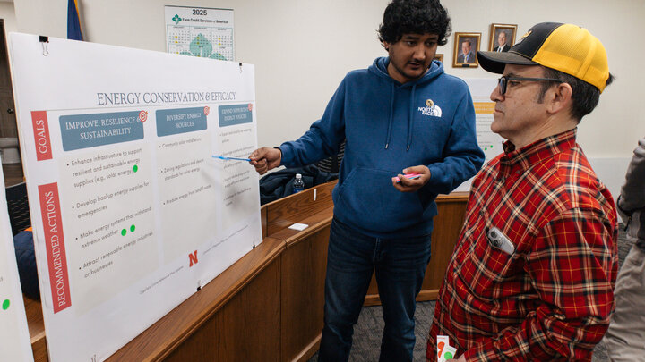
Risha Singh, a master student in the Community and Regional Planning Program, is developing community-based flood risk maps to inform landowners, developers and policymakers about flood risks. These working products are shared with stakeholders to enhance community resilience planning, contributing to the project’s goal of creating a safer and more informed Nebraska.
By the end of 2025, the team will have evaluated existing efforts and produced a guidebook for local and regional planning that shows how mitigation measures and resilient building standards can be integrated into local plans, policies and procedures.


